Geospatial analysis is a powerful technique that involves examining and interpreting data related to geographic locations. It allows businesses and organizations to gain valuable insights, make informed decisions, and optimize various processes.
However, geospatial analysis also comes with challenges, while providing numerous opportunities. One of the challenges in geospatial analysis is dealing with large and complex datasets. Geospatial data can be vast and varied, including satellite imagery, GPS coordinates, addresses, and demographic information.
Managing and processing such data requires robust systems and algorithms to ensure accurate analysis and interpretation. Another challenge is the integration of different data sources.
Geospatial analysis often involves combining data from multiple sources, such as mapping services, government databases, or proprietary datasets. Ensuring data compatibility, consistency, and quality is crucial for accurate analysis.
However, geospatial analysis offers numerous opportunities. It allows businesses to understand customer behavior, optimize supply chains, plan infrastructure development, and conduct market analysis. For example, retailers can use geospatial analysis to identify optimal store locations based on demographic data and competition analysis.
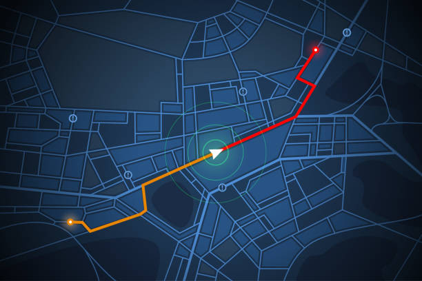
Data is very valuable, even more so when you are looking to optimize logistics tasks, that’s why we would like to show you what kind of data you can get and how you can use a distance API!

What Uses Can You Give To A Distances API In Geospatial Analysis?
Implementing a distances API allows organizations to accurately calculate distances between locations, enabling proximity analysis, route optimization, and service area delineation.
It can be used to calculate straight-line distances, driving distances, or even travel times, depending on the specific requirements. This distance measurement capability allows for more precise analysis, such as determining the nearest facilities, identifying clusters or hotspots, or optimizing logistics and transportation routes.
To implement an API for distance measurement, developers can integrate it into existing geospatial analysis software or build custom applications. Through distance measurement functionality, organizations can streamline their geospatial analysis processes, improve accuracy, and enhance decision-making.
Additionally, an API that measures distances can provide flexibility in unit conversion, accommodating different measurement systems and preferences. This is especially beneficial for organizations operating on a global scale or serving diverse user bases.
How Does A Distances API Work?
A distances API employs diverse data sources and algorithms to precisely determine distances using geographic coordinates or addresses.
The resulting data holds immense value, especially when aiming to enhance logistics operations, which is why we would like to showcase the types of data that can be obtained.
For this example, we chose The Distance API, actually available on the ZylaLabs Hub. We chose it since we found it fast and give reliable answers. Let’s see an example:
Let’s try entering latitude and longitude values into the “Get Distance In Miles” endpoint, for example, will provide the following response:
{
  "latitudeA": 31.5186,
  "longitudeA": 81.8132,
  "latitudeB": 30.0522,
  "longitudeB": 78.2437,
  "distance": 234.84,
  "uom": "mi"
}
Or you can use the “Get Distance In Kilometres” endpoint, for example, and you will receive the following response:
{
  "latitudeA": 30.5279,
  "longitudeA": 81.8102,
  "latitudeB": 28.0518,
  "longitudeB": 1162406,
  "distance": 10595.17,
  "uom": "km"
}
Thus, either of the two endpoints will show you in Kilometers (Km) or Miles (Mi) the distance between the selected points.
How Can You Get Started With The Distances API?

- To get started, navigate to The Distances API and click the “START FREE TRIAL” button.
- You will be able to use the API after joining Zyla API Hub!
- Select the API endpoint you need.
- Then, by selecting the “test endpoint” button, you will make an API request; and see the results shown on the screen.
Related Post: Get Location Information From A Number Using A Mobile Phone Validation