If you happen to work in the maritime industry, you should keep reading to find out how to make your job easier.
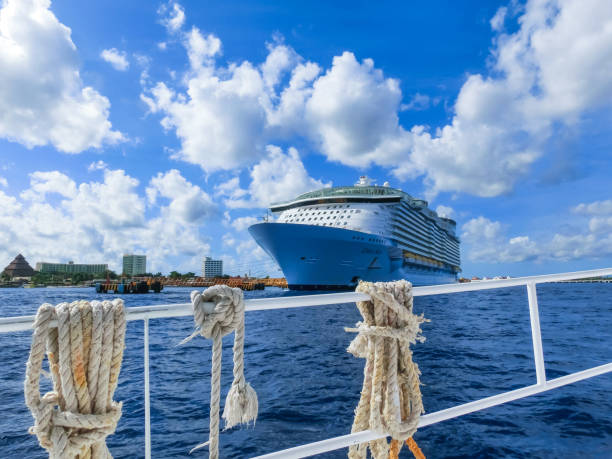
The maritime industry plays a crucial role in global trade and transportation, with thousands of ships constantly traversing the world’s oceans to deliver goods and passengers to every corner of the world. Navigation is a critical aspect of maritime operations, ensuring the safe and efficient movement of ships on the water. In recent years, the use of vessel finder APIs (Application Programming Interfaces) has emerged as a powerful tool for enhancing navigation in the maritime industry. In this article, we will explore how ship-tracking APIs can benefit the maritime industry and improve navigation.
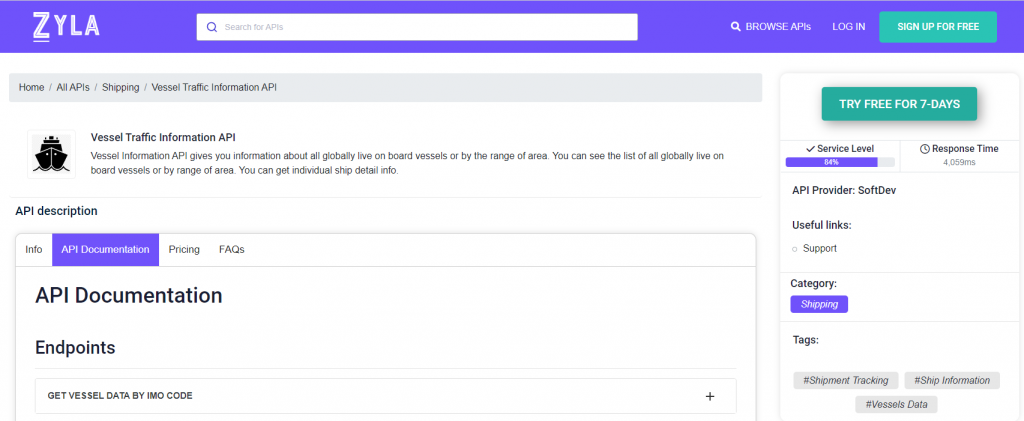
If you need to find your way through so many hoops, our pick to make your work a breeze is Zyla’s Vessel Traffic Information API, a versatile tool that can truly turn the tides towards efficiency, saving hundreds of man-hours with a single click.
Vessel finder APIs provide access to real-time and historical data about ship locations, movements, and other relevant information. This data is collected through various sources, such as satellite-based tracking systems, Automatic Identification System (AIS) receivers, and other maritime databases. Vessel finder APIs can be integrated into various maritime applications and systems, such as vessel traffic management systems, fleet management software, maritime analytics platforms, and other navigation-related tools. Let’s take a look at the one mentioned above.
How Does This API Work?
Vessel Traffic Information API is a very powerful and versatile tool that has three main ways to be operated, each mode results in different types of output, which can in turn be used to satisfy different needs, providing the information you are looking for in different situations:
- GET VESSEL DATA BY IMO CODE: with this mode, you need a ship’s IMO code as input, and as output, you’ll get information on the ship in question, such as its location, and general information about it, as its length, it’s maxed draught, the year it was launched, and more.
- GET CURRENT ROUTE BY IMO CODE: with this function, which also requires an IMO code, you’ll get information like the departure port and destination of a particular ship.
- GET POSITION: this function asks for a particular set of coordinates, that is, latitude and longitude, and as output, you’ll get a list of all the ships that happen to be in that area.
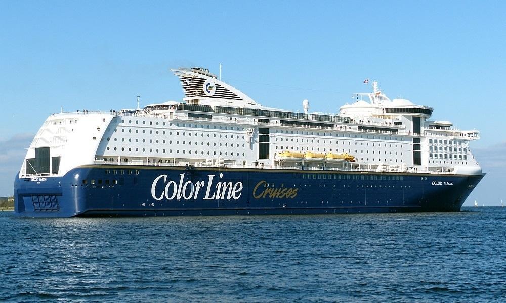
To give an example of how this API works, here’s the output for the second option, if one would want to check on the route currently being followed by the cruise ferry MS Color Magic, (pictured above) one can easily find out simply by providing the ship’s IMO number:
{
  "status": 200,
  "success": true,
  "message": "IMO Code 9349863 is valid",
  "data": {
    "departure_port": "Oslo, Norway",
    "departure_atd": "ATD: Apr 14, 12:04 UTC (12 hours ago)",
    "callsign": "LNWC",
    "flag": "Norway",
    "length_beam": "224 / 36 m",
    "imo_mmsi": "9349863 / 259222000",
    "navigation_status": "Under way",
    "current_draught": "6.9 m",
    "course_speed": " ",
    "arrival_port": "Kiel, Germany",
    "arrival_atd": "ETA: Apr 15, 08:00",
    "latest_port_calls": [
      {
        "port_name": "Oslo, Norway",
        "arrival_utc": "2023-04-14T07:42:00.000000Z",
        "departure_utc": "2023-04-14T12:04:00.000000Z",
        "time_in_port": "4 hours, 22 minutes"
      },
      {
        "port_name": "Kiel, Germany",
        "arrival_utc": "2023-04-13T07:22:00.000000Z",
        "departure_utc": "2023-04-13T12:16:00.000000Z",
        "time_in_port": "4 hours, 54 minutes"
      },
      {
        "port_name": "Oslo, Norway",
        "arrival_utc": "2023-04-12T07:39:00.000000Z",
        "departure_utc": "2023-04-12T12:02:00.000000Z",
        "time_in_port": "4 hours, 23 minutes"
      },
      {
        "port_name": "Kiel, Germany",
        "arrival_utc": "2023-04-11T07:25:00.000000Z",
        "departure_utc": "2023-04-11T12:21:00.000000Z",
        "time_in_port": "4 hours, 56 minutes"
      },
      {
        "port_name": "Oslo, Norway",
        "arrival_utc": "2023-04-10T07:40:00.000000Z",
        "departure_utc": "2023-04-10T11:57:00.000000Z",
        "time_in_port": "4 hours, 17 minutes"
      }
    ]
  }
}
As you can see, the information provided is accurate up to the minute. This kind of information, when integrated into an app or a website, can be truly impactful for any maritime operation. You can try it out for free with the following instructions:
1- Go to Vessel Traffic Information API and simply click on the button “Try Free For 7-Days” to start using the API.
2- Employ the different API endpoints depending on what you are looking for.
3- Once you meet your needed endpoint, make the API call by pressing the button “run” and see the results on your screen.