
If you work for the maritime industry, you know how competitive that work environment can get. We have a recommendation to give you a leg up below!
The maritime industry relies heavily on efficient vessel tracking and monitoring for various purposes, such as fleet management, cargo tracking, and maritime safety. Developing applications or websites for the maritime industry requires reliable and accurate ship-tracking data, which can be obtained through ship-tracking APIs. In this article, we will explore how vessel finder APIs make developing maritime apps or websites easier and more streamlined.
So, What is a Vessel Finder API?
A vessel finder API (Application Programming Interface) is a set of protocols and tools that enable developers to integrate ship tracking data into their applications or websites. These APIs provide access to real-time or historical information about vessel movements, positions, routes, and other relevant data. Ship Tracking APIs are typically offered by third-party providers that collect and aggregate data from multiple sources, such as satellite AIS (Automatic Identification System), terrestrial AIS, radar, and other maritime sensors. Ship tracking APIs provide several benefits, such as:
- Access to Accurate and Real-time Data: Ship tracking APIs provide developers with access to accurate and real-time ship tracking data, which is crucial for maritime applications. Developers can retrieve vessel positions, routes, and other information in real-time, allowing them to build apps or websites that provide up-to-date and reliable tracking services to end users.
- Simplified Data Integration: Ship tracking APIs come with pre-built functions and endpoints that abstract the complexity of data retrieval and processing. Developers can easily integrate the API into their applications or websites, without the need to build complex data retrieval or processing logic from scratch. This saves time and effort in development, allowing developers to focus on other aspects of their app or website.
- Customization and Flexibility: Vessel finder APIs are typically flexible and customizable, allowing developers to tailor the tracking data to suit their specific needs. Developers can choose the data fields they want to retrieve, filter data based on specific criteria, and customize the data presentation to match the look and feel of their app or website. This flexibility enables developers to create unique and differentiated maritime applications that meet the requirements of their target audience.
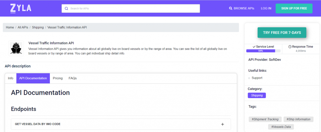
Since the need for accurate and easily available data is so important in the maritime industry, one should always try to stay ahead of the curve, as technology becomes more widespread. This is why we recommend Zyla’s Vessel Traffic Information API.
How Does This API Work?
Vessel Traffic Information API is a powerful and versatile tool that has three main ways to be operated, each mode results in different types of output, which can, in turn, be used to satisfy different needs, providing the information you are looking for in different situations:
- GET VESSEL DATA BY IMO CODE: with this mode, you need a ship’s IMO code as input, and as output, you’ll get information on the ship in question, such as its location, and general information about it, such as its length, it’s maxed draught, the year it was launched, and more.
- GET CURRENT ROUTE BY IMO CODE: with this function, which also requires an IMO code, you’ll get information like the departure port and destination of a particular ship.
- GET POSITION: this function asks for a particular set of coordinates, that is, latitude and longitude, and as output, you’ll get a list of all the ships that happen to be in that area.
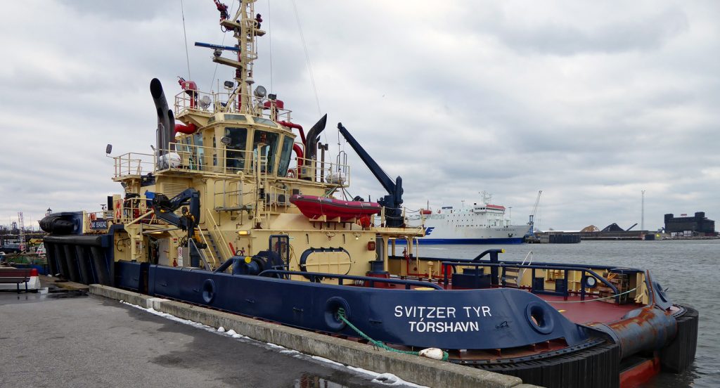
To give an example of how this API works, here’s the output for the second option, if one would want to check on the route currently being followed by the tugboat Svitzer Tyr (pictured above) which is easily achievable by providing the API with her IMO code:
{
  "status": 200,
  "success": true,
  "message": "IMO Code 9548342 is valid",
  "data": {
    "departure_port": "Goteborg, Sweden",
    "departure_atd": "ATD: Apr 15, 06:42 UTC (2 days ago)",
    "callsign": "OZ2118",
    "flag": "Faeroe Islands",
    "length_beam": "33 / 13 m",
    "imo_mmsi": "9548342 / 231809000",
    "navigation_status": "Moored",
    "current_draught": "5.4 m",
    "course_speed": " ",
    "arrival_port": "Goteborg, Sweden",
    "arrival_atd": "ATA: Apr 15, 07:52 UTC",
    "latest_port_calls": [
      {
        "port_name": "Goteborg, Sweden",
        "arrival_utc": "Apr 15, 07:52",
        "departure_utc": "-",
        "time_in_port": "-"
      },
      {
        "port_name": "Goteborg, Sweden",
        "arrival_utc": "2023-04-13T23:23:00.000000Z",
        "departure_utc": "2023-04-15T06:42:00.000000Z",
        "time_in_port": "1 days, 7 hours, 19 minutes"
      },
      {
        "port_name": "Goteborg, Sweden",
        "arrival_utc": "2023-04-13T22:17:00.000000Z",
        "departure_utc": "2023-04-13T23:17:00.000000Z",
        "time_in_port": "1 hours, "
      },
      {
        "port_name": "Goteborg, Sweden",
        "arrival_utc": "2023-04-13T06:22:00.000000Z",
        "departure_utc": "2023-04-13T20:51:00.000000Z",
        "time_in_port": "14 hours, 29 minutes"
      },
      {
        "port_name": "Goteborg, Sweden",
        "arrival_utc": "2023-04-12T08:56:00.000000Z",
        "departure_utc": "2023-04-13T04:00:00.000000Z",
        "time_in_port": "19 hours, 4 minutes"
      }
    ]
  }
}
As you can see, the data provided is extremely accurate. This kind of information, when integrated into an app or a website, can be truly impactful for any maritime operation. You can try it out for free with the following instructions:
1- Go to Vessel Traffic Information API and simply click on the button “Try Free For 7-Days” to start using the API.
2- Employ the different API endpoints depending on what you are looking for.
3- Once you meet your needed endpoint, make the API call by pressing the button “run” and see the results on your screen.