If you work in the maritime industry, it’s important to work smart, not hard. You can find a tool to do so below!
The maritime industry relies heavily on efficient and accurate shipping routes to ensure the smooth movement of vessels, cargo, and passengers across the world’s oceans. Calculating optimal shipping routes involves taking into account a staggering amount of factors such as weather conditions, sea currents, vessel performance, and port schedules. In recent years, the use of maritime data APIs has emerged as a crucial tool for the maritime industry to better calculate shipping routes. In this article, we will explore three fields in which the importance of maritime data APIs for calculating shipping routes with precision is key.
So…why?
- Enhanced Operational Efficiency: The use of ship tracking APIs for calculating shipping routes can significantly enhance operational efficiency for maritime companies. By leveraging accurate and real-time data, companies can optimize routes, reduce fuel consumption, minimize vessel idle time, and optimize port calls. This leads to improved vessel utilization, reduced operational costs, and enhanced overall efficiency in the shipping process.
- Flexibility and Scalability: Maritime data APIs offer flexibility and scalability, allowing maritime companies to adapt to changing business needs. APIs can be easily integrated into existing systems or applications, providing a seamless solution for route calculation requirements. Additionally, APIs often offer customization options, allowing companies to tailor the functionalities to their specific needs. This makes ship-tracking APIs a flexible and scalable solution for every maritime operation.
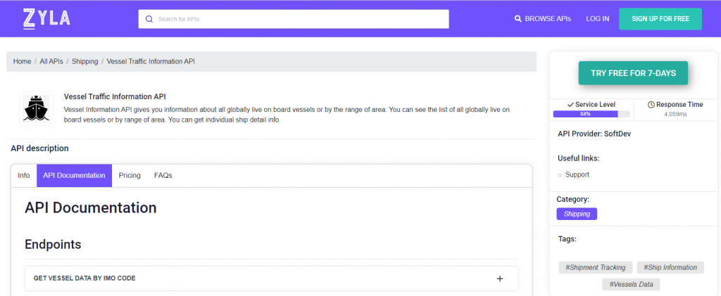
Making the right choice when it comes to using an API for these tasks can be daunting, and we recommend Zyla’s Vessel Traffic Information API because it’s extremely flexible and easy to use, and when it comes to calculating maritime routes, it’s second to none.

What Are The Use Cases For This API?
Vessel Tracking Information API, as stated above, is very easy to use and to integrate. It has three main functions, which result in different types of output, which can in turn be used to satisfy different needs:
- GET VESSEL DATA BY IMO CODE: with this mode, you need a ship’s IMO code as input, and as output, you’ll get information on the boat in question, such as its location, and general information about it, such as its length, it’s maxed draught, the year it was launched, and more.
- GET CURRENT ROUTE BY IMO CODE: with this function, which also requires an IMO code, you’ll get information like a particular ship’s departure port and destination.
- GET POSITION: this function asks for a particular set of coordinates, that is, latitude and longitude, and as output, you’ll get a list of all the ships that happen to be in that area.
To give an example of how this API works, here’s the output for the second option, if one would want to check the current route of the passenger ship Oasis Of The Sea (pictured above) which is easily accessed by providing her IMO (9383936):
{
  "status": 200,
  "success": true,
  "message": "IMO Code 9383936 is valid",
  "data": {
    "departure_port": "Roatan, Honduras",
    "departure_atd": "ATD: Apr 13, 21:20 UTC (21 hours ago)",
    "callsign": "C6XS7",
    "flag": "Bahamas",
    "length_beam": "360 / 60 m",
    "imo_mmsi": "9383936 / 311020600",
    "navigation_status": "-",
    "current_draught": "9.3 m",
    "course_speed": " ",
    "arrival_port": "COSTA MAYA",
    "arrival_atd": "ETA: Apr 14, 11:00",
    "latest_port_calls": [
      {
        "port_name": "Roatan, Honduras",
        "arrival_utc": "2023-04-13T12:32:00.000000Z",
        "departure_utc": "2023-04-13T21:20:00.000000Z",
        "time_in_port": "8 hours, 48 minutes"
      },
      {
        "port_name": "Cozumel, Mexico",
        "arrival_utc": "2023-04-12T11:11:00.000000Z",
        "departure_utc": "2023-04-12T22:58:00.000000Z",
        "time_in_port": "11 hours, 47 minutes"
      },
      {
        "port_name": "Port Everglades, United States (USA)",
        "arrival_utc": "2023-04-11T03:03:00.000000Z",
        "departure_utc": "2023-04-11T04:11:00.000000Z",
        "time_in_port": "1 hours, 8 minutes"
      },
      {
        "port_name": "Little Stirrup Cay, Bahamas",
        "arrival_utc": "2023-04-10T12:01:00.000000Z",
        "departure_utc": "2023-04-10T20:37:00.000000Z",
        "time_in_port": "8 hours, 36 minutes"
      },
      {
        "port_name": "Miami, United States (USA)",
        "arrival_utc": "2023-04-09T06:25:00.000000Z",
        "departure_utc": "2023-04-09T20:59:00.000000Z",
        "time_in_port": "14 hours, 34 minutes"
      }
    ]
  }
}
Vessel Traffic Information API is designed to be easily integrated into various applications or websites, making it simple for companies to incorporate ship tracking functionality into their existing systems, and as it’s clear, it’s a very accurate and powerful tool. You can try out the following these simple steps:
1- Go to Vessel Traffic Information API and simply click on the button “Try Free For 7-Days” to start using the API.
2- Employ the different API endpoints depending on what you are looking for.
3- Once you meet your needed endpoint, make the API call by pressing the button “run” and see the results on your screen.