
If you work in the maritime industry, we invite you to keep reading this article to find out how to make your job easier.
The maritime industry has long relied on advanced technologies for efficient and safe navigation at sea. With the advancements of ship finder APIs (Application Programming Interfaces), the industry has a new and powerful tool to enhance navigation capabilities and optimize its operations. Vessel finder APIs provide real-time data and insights on vessel positions, routes, and other critical information, which can be integrated into various maritime applications and systems to improve decision-making, enhance safety, and streamline logistics.
Ship tracking APIs offer a range of benefits for the maritime industry. Here are some key ways how to ship tracking APIs can enhance navigation:
- Real-time vessel tracking: Vessel finder APIs provide real-time data on vessel positions, allowing maritime operators to monitor and track ships in real time. This enables them to have a comprehensive view of vessel movements, locations, and routes, helping them make informed decisions about routing, scheduling, and logistics. Real-time vessel tracking can also aid in identifying potential collisions, managing port operations, and responding to emergencies effectively.
- Efficient fleet management: Vessel finder APIs can be integrated into fleet management systems, allowing maritime operators to monitor and manage their vessels more efficiently. Fleet managers can track vessel positions, fuel consumption, engine performance, and other operational data to optimize fleet utilization, reduce downtime, and improve overall fleet performance. Ship tracking APIs can also assist in managing vessel maintenance, scheduling, and compliance with regulatory requirements.
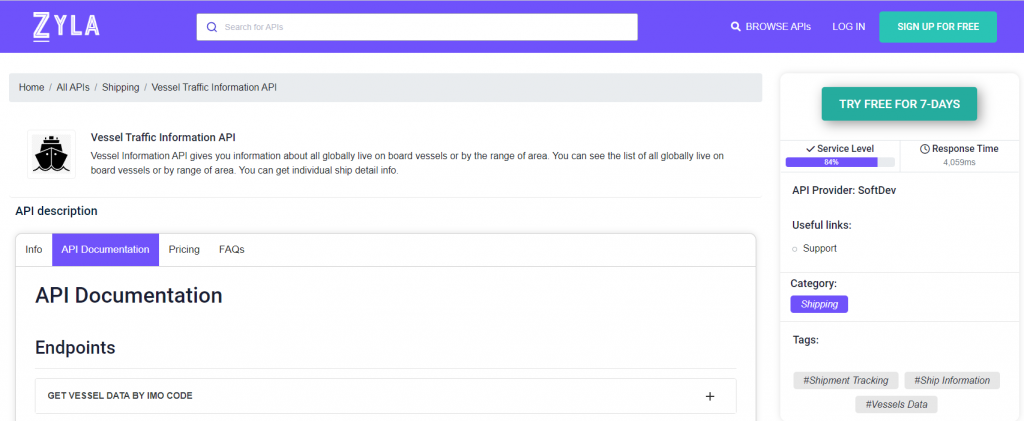
With over a hundred thousand ships at sea everyday, the task of keeping tabs and improving navigation is extremely challenging. Thankfully, Zyla’s Vessel Traffic Information API offers a very solid suite of options that can enable your business to sail smoothly, literally.
How To Use This API?
Vessel Tracking Information API is a very flexible tool, and it’s easy to integrate into any app or website you might be working on. It has three main functions, which results in different types of output, which can in turn be used to satisfy different needs:
- GET VESSEL DATA BY IMO CODE: with this mode, you need a ship’s IMO code as input, and as output, you’ll get information on the boat in question, such as its location, and general information about it, such as it’s length, it’s maxed draught, the year it was launched, and more.
- GET CURRENT ROUTE BY IMO CODE: with this function, which also requires an IMO code, you’ll get information like a particular ship’s departure port and destination.
- GET POSITION: this function asks for a particular set of coordinates, that is, latitude and longitude, and as output, you’ll get a list of all the ships that happen to be in that area.
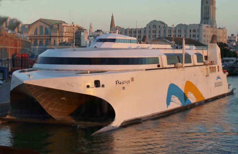
To give an example of how this API works, here’s the output for the second option, if one would want to check the current route of the high-speed catamaran Francisco (pictured above) which is easily accessed by providing her IMO (9610028 ):
{
  "status": 200,
  "success": true,
  "message": "IMO Code 9610028 is valid",
  "data": {
    "departure_port": "Buenos Aires, Argentina",
    "departure_atd": "ATD: Apr 14, 19:31 UTC (1 hour ago)",
    "callsign": "CXOJ",
    "flag": "Uruguay",
    "length_beam": "99 / 26 m",
    "imo_mmsi": "9610028 / 770576272",
    "navigation_status": "Under way",
    "current_draught": "3.0 m",
    "course_speed": " ",
    "arrival_port": "MVD.BSAS.MVD",
    "arrival_atd": "ETA: Apr 14, 13:57",
    "latest_port_calls": [
      {
        "port_name": "Buenos Aires, Argentina",
        "arrival_utc": "2023-04-14T17:31:00.000000Z",
        "departure_utc": "2023-04-14T19:31:00.000000Z",
        "time_in_port": "2 hours, "
      },
      {
        "port_name": "Montevideo, Uruguay",
        "arrival_utc": "2023-04-14T13:54:00.000000Z",
        "departure_utc": "2023-04-14T14:56:00.000000Z",
        "time_in_port": "1 hours, 2 minutes"
      },
      {
        "port_name": "Buenos Aires, Argentina",
        "arrival_utc": "2023-04-14T01:05:00.000000Z",
        "departure_utc": "2023-04-14T11:26:00.000000Z",
        "time_in_port": "10 hours, 21 minutes"
      },
      {
        "port_name": "Montevideo, Uruguay",
        "arrival_utc": "2023-04-13T21:34:00.000000Z",
        "departure_utc": "2023-04-13T22:35:00.000000Z",
        "time_in_port": "1 hours, 1 minutes"
      },
      {
        "port_name": "Buenos Aires, Argentina",
        "arrival_utc": "2023-04-13T16:53:00.000000Z",
        "departure_utc": "2023-04-13T19:07:00.000000Z",
        "time_in_port": "2 hours, 14 minutes"
      }
    ]
  }
}
Vessel Traffic Information API is designed to be easily integrated into various applications or websites, making it simple for companies to incorporate ship tracking functionality into their existing systems, and as it’s clear, it’s a very accurate and powerful tool. You can try it out for free by following these simple steps:
1- Go to Vessel Traffic Information API and simply click on the button “Try Free For 7-Days” to start using the API.
2- Employ the different API endpoints depending on what you are looking for.
3- Once you meet your needed endpoint, make the API call by pressing the button “run” and see the results on your screen.