People who manage maritime agencies and shipping companies need tools to track down ships and information about them, in every corner of the planet.
Thus they request from developers to devise efficient tools that can ease the process. A good basis for developers is a vessel traffic information software that guarantees accuracy and ease-of-use.
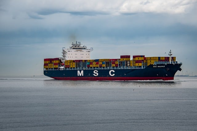
Vessel Traffic Information API is the ultimate tool for shipping intelligence. It provides real-time information on ship movements, including location, ID, name, type, route, speed, destination, heading and more. This API is ideal for shipping companies, maritime agencies, and those involved in the business, who need to track the movement of ships.
Vessel Traffic Information API is the most comprehensive and accurate tool for tracking ship movements. It provides detailed information on ship operations, which provides real-time data on vessel traffic in ports around the world. With Vessel Traffic Information API one can get access to data on all kinds of vessels including cargo ships, cruise ships, tankers, ferries, yachts – you name it! And this data can be really useful for a wide range of applications – from maritime safety, through environmental monitoring, to security applications.
This API is easy to use and provides accurate information on vessel activity. This is the perfect solution for keeping updated information about vessel traffic.
There are many benefits to using Vessel Traffic Information API. One of the biggest benefits is that it can help improve efficiency. By knowing where certain ships are, one can plan routes more effectively and avoid delays. It can also help save money by allowing to plan ahead for maintenance and repairs. By knowing when one´s ships need maintenance, it`s possible to schedule the work at a time when it will have the least impact on operations.
Vessel Traffic Information API also allows to trackone´s fleet’s fuel consumption, which helps save money on fuel costs. By tracking one´s fleet’s fuel consumption, it`s possible to identify areas where to save fuel. This API also helps improve safety by allowing to track the fleet’s location and speed. This can help ensure that one´s ships are operating safely and within regulations.
How Does A Tracking System Work?
A tracking system tracks the location of objects or people. There are many different types of tracking systems, including GPS tracking, cell phone tracking, and satellite tracking.
GPS tracking is the most common type of tracking system. On using a GPS tracking system, a GPS receiver receives these signals and uses them to determine a certain location. The location data is then sent to a server, which stores it in a database. Then it`s possible to view this data on a map or graph. There are many uses for tracking systems, including law enforcement, navigation, and geocatching.
How To Get Started With This API
Counting on a subscription on Zyla API Hub marketplace, just start using, connecting and managing APIs. Subscribe to Vessel Traffic Information API by simply clicking on the button “Start Free Trial”. Then meet the needed endpoint and simply provide the search reference. Make the API call by pressing the button “test endpoint” and see the results on display. The AI will process and retrieve an accurate report using this data.
Vessel Traffic Information API examines the input and processes the request using the resources available (AI and ML). In no time at all the application will retrieve an accurate response.
By choosing an endpoint in the API (GET VESSEL DATA BY IMO CODE, GET CURRENT ROUTE BY IMO CODE or GET POSITION) and then inputting the identification number of the vessel, the software will output a full report with all the necessary information. In this case the endpoint is Get Position and the vessel is 9251183. The response will look like this:
{
"status": 200,
"success": true,
"message": "IMO Code 9251183 is valid",
"data": {
"position_received": "2023-05-24 18:54 LT (UTC +2)1 minute ago",
"vessel_local_time": "2023-05-24 18:54 LT (UTC +2)",
"area": "EMED - Aegean Sea",
"current_port": "-",
"latitude_longitude": "36.52876° / 23.5374°",
"navigational_status": "Underway using Engine",
"speed_course": "13.6 kn / 61 °",
"ais_source": "Chania Galatas (operated by SV9KI)"
}
}