
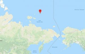
Several users of Google Maps reported a strange cases. They were covered with a black spot in images of a small Russian islet near the arctic.
In general, Google Maps covers some national security zones at the request of governments. It is very common that nuclear power stations, prisons or military bases appear blocked in the satellite service.
That is why it intrigues the reasons that led to cover the island Jeannette, which is located in the East Siberian Sea. It is not clear why the island is blurred, although thousands of theories circulated on social networks.
This shows the area where the island is.
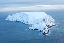
This is the satellite view of the island.
However, after the Imperial Russian Arctic Ocean Hydrographic Expedition of 1910-1915, Russia publicly announced that Jeanette, along with other Arctic islands, was part of the Russian Federation. Since then, each country claims it.
Swedish scientists expedition to the island of Jeannette.
There is no clear reason to explain why the remote island is blocked. Google still did not give explanations about it, but it could probably be an error or technical problem of the software or the satellite.